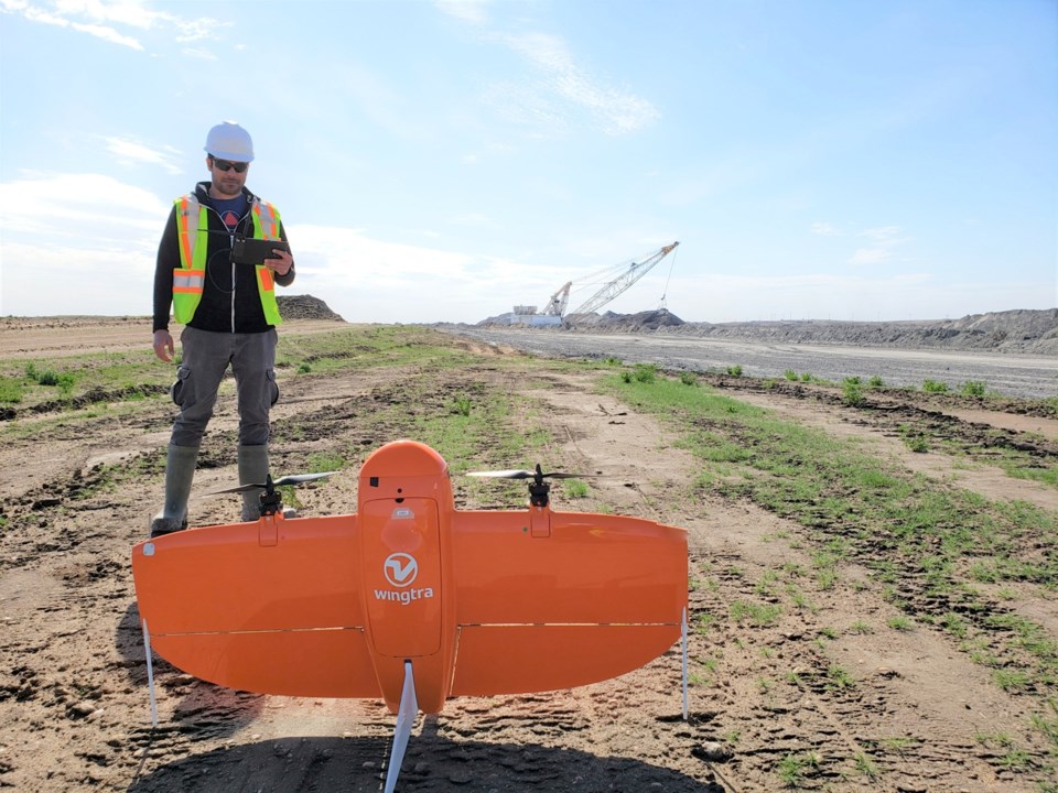
Technology is ever evolving and playing a growing role in the operations of businesses and industries, and it’s no different at Westmoreland Mining Holdings LLC’s Estevan mine.
Among the technologies that have been adopted are drones, and they have made the mines’ operations more efficient.
Mohsin Hashmi, who is a junior mining engineer, has been working with the drones for about a year, and has quickly become proficient in their use. They run two different types of drones – the traditional quad copters and hybrid drones.
“The difference between quad copters and hybrid drones is … quad copters are your recreational drones that you can utilize in the mining context to get videos of areas of concern, which, in the past, people had to go on foot to capture. Right now, with drone technology, we can see dragline issues; rather than a person climbing up, they can view the dragline problems, structural issues. We can monitor environmental progress at a micro scale,” said Hashmi.
“With the hybrid done cutting edge technology that we have, it’s called vertical takeoff and landing technology, it’s the second type of drone that we use. This is for a larger coverage of area. We’re talking about 700 or 800 hectares. In the past, traditional surveying would have taken a week to capture production data, stockpile data, reclamation data, especially about our sustainability objectives.”
Planning and designing for the mine roads and pits would have taken weeks, but thanks to Wingtra 1 vertical takeoff and landing (VTOL) hybrid unit, the drone captures hundreds of hectares of data with accuracy and very good resolution in 20 minutes.
Production, stockpiles, reclamation, design and other aspects have benefitted from drone use.
Using the VTOL technology at Westmoreland, Hashmi will go out and survey the stockpiles with the drone, survey the pits, capture the photos with the drone and process the software using static satellite data to geo-reference each photo taken.
“We use photogrammetry technology … to develop 3-D models. So you take a tonne of pictures from the drone, but you can stitch those photos together with these processing softwares, where they can make a 3-D model of the area that you’re working in.”
It feeds into their analytics to calculate how much coal they have in the pits, the road width, the amount of coal the dragline has uncovered and the amount of reclamation they have done to meet their sustainability objectives.
Hashmi said the mines adopted drone technology at an early stage back in 2014. In the past two years, they have adopted the VTOL to make the drone usage more accurate and safe, to cover more area and get as good of data to feed the operations.
An intern who works with Hashmi also knows how to operate the VTOL drone, but the data generated by the drone is used by the entire technical services department, as well as SaskPower.
As for the conventional drone, it is used by all departments at the mine, from environment to technical to dragline maintenance and inspection.
“This is the trend that you can see in the industry, and we are pushing the limits,” said Hashmi.
The accuracy of predicting the inventory of coal that they have is now at a centimetre, the resolution of the models that help with planning is stronger because the drones have a high-resolution camera at 42 megapixels, and the amount of area they can cover is enhanced.
As a bonus, the technology is very easy to pick up for a student or anybody who is a novice. He noted that the guidance and nurturing of the management at the Estevan mine has allowed him to explore different options and implement a lot of things that wouldn’t be possible in a larger setting, and so he has gained a quicker understanding of how the drones work.
The initial drone technology would have required a couple of hours to cover a large area.
“You can have a drone basically georeference everything. Basically it’s a drone with a GPS.”
And they help the mines cut costs, because not only are they more efficient, but they’re more affordable than traditional forms of surveying.


